

OVERVIEW
In 2019, the KLFHP collectively decided to start the Thomas Creek Forest Health Project (TCFHP) which is located immediately west and adjacent to the North Warner Project in Lake County. This project area extends south below Drew Reservoir and northwest above Valley Falls, encompassing over 200,000 acres of public and private land.
Similar to the North Warner Project, it was selected because it included the NEPA-ready USFS Thomas Creek Project and there was extensive aquatic restoration already completed on both public and private lands - presenting the opportunity for ridgetop to ridgetop restoration.
The Lake County All Lands Restoration Initiative combines the North Warner and Thomas Creek Projects. The partnership envisions creating a healthy, resilient, and functional forest landscape maintained with fire as an ecological process, while mitigating the threat of high severity wildfire to dry forests, fish and wildlife habitat, water quality, and the surrounding human communities. The focus on dry forest restoration will be to complete thinning treatments in forested communities and to utilize prescribed fire as a follow-up within the North Warner Project, while beginning thinning treatments within the Thomas Creek Project in preparation for future prescribed fire. See our Lake County All Lands Restoration Initiative Strategic Action Plan to see how we will move forward in these landscapes starting in 2020.
OUTREACH
May 2019 - Partners reached out to 172 different property owners within the Thomas Creek project boundary. Efforts included mailings, phone calls, and in-person meetings to explain the scope of the project and the unique opportunity for property owners to improve their land and reach their restoration goals and objectives.
September 2019 - 45% of those contacted have confirmed their interest in future treatment options. Landowners will continue to received status updates as the project moves towards implementation.
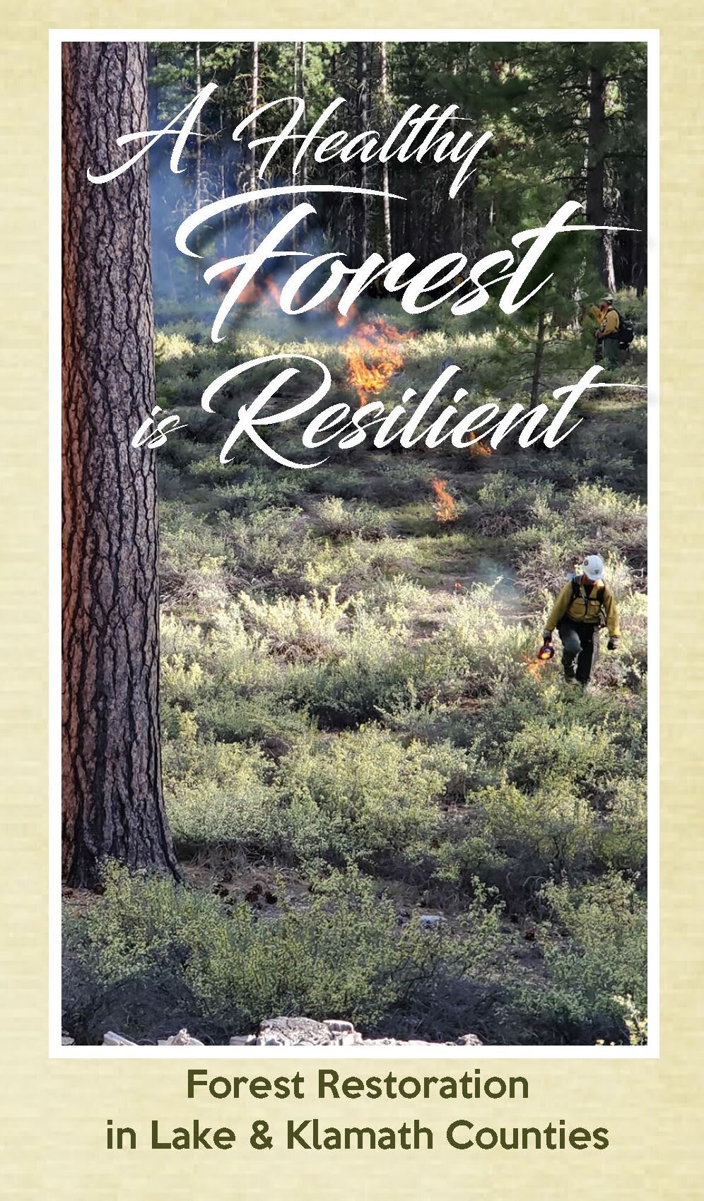
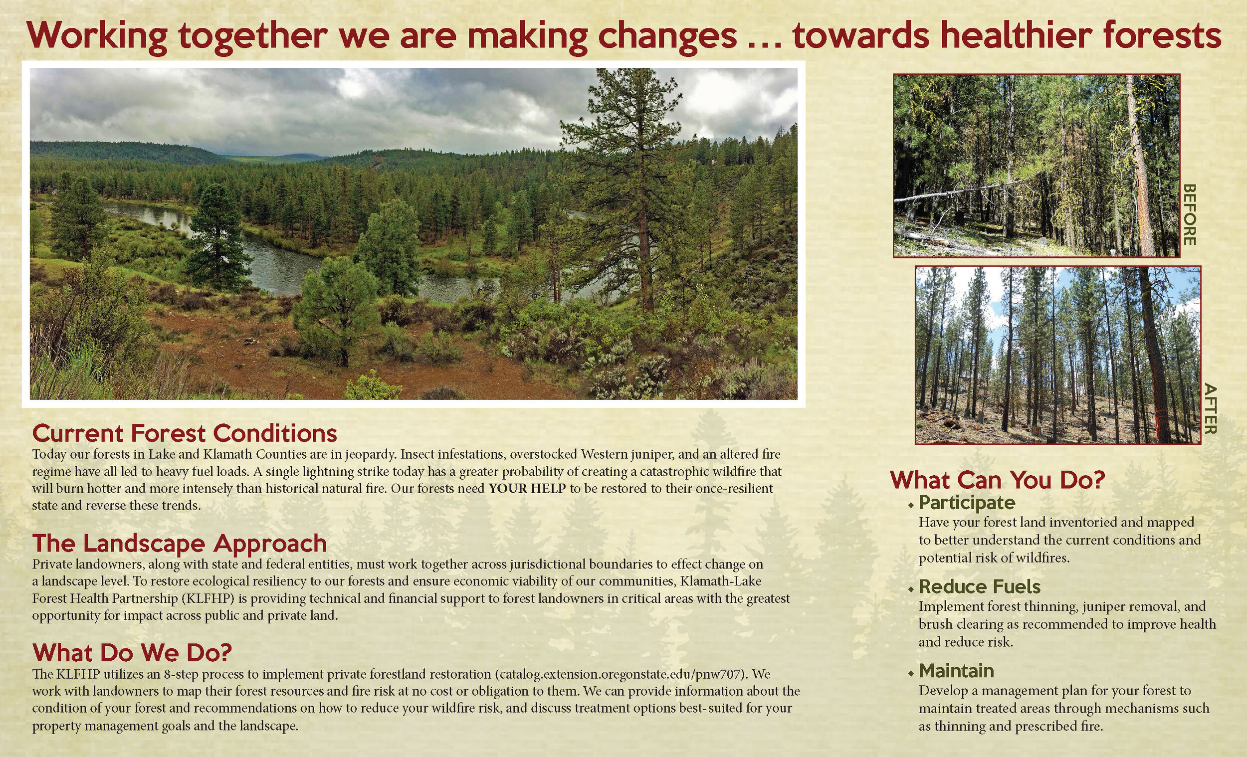
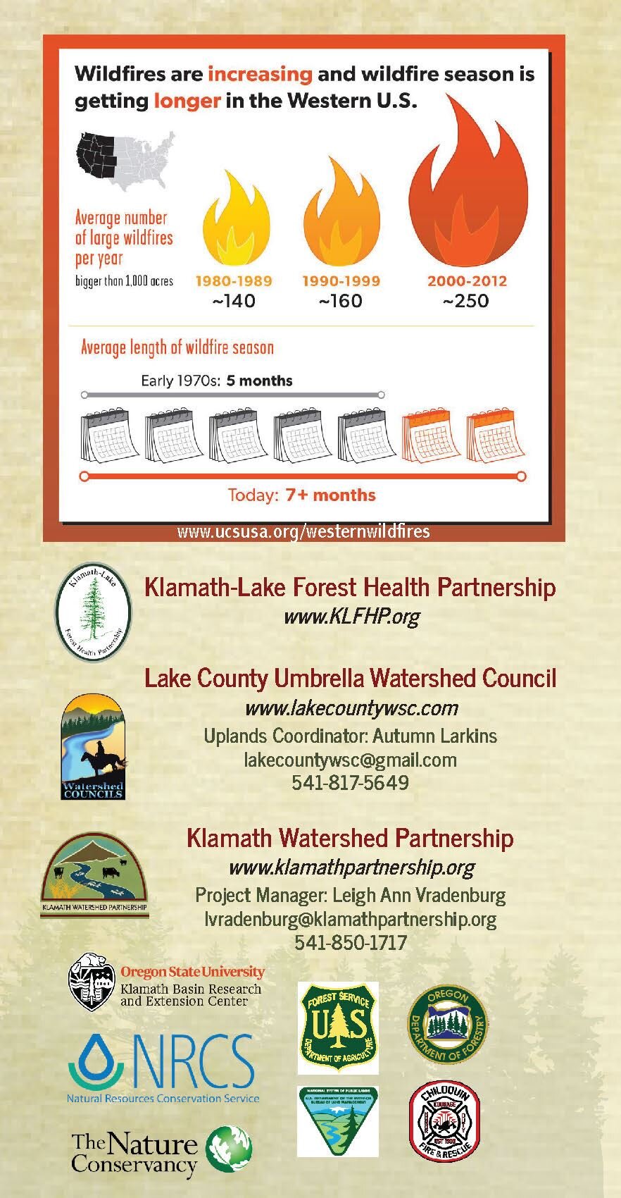
The brochure below was produced by the Lake County Umbrella Watershed Council in partnership with the KLFHP in 2020 to convey the need for forest restoration and to serve as a tool when reaching out to landowners. This effort was funded by a grant from the Oregon Watershed Enhancement Board. Click on an image to access the pdf version.
MAPPING

June 2019 – A six-person crew of high school and college students were hired through an Oregon Watershed Enhancement Board (OWEB) grant to survey and inventory forest characteristics on the ground. Permission was received by property owners where the crews worked to obtain overstory and understory tree and shrub cover type, stand density, and fuel loading, along with location of invasive weeds, springs, aspen, and mountain mahogany. The information gathered will be compiled to create priority area maps for resource managers and landowners. The data and maps will serve as a valuable resource tool for implementation.
October 2019 - Approximately 46,000 acres of private land in the Thomas Creek area has been mapped and inventoried.

October 2019 - Mapping efforts have been completed. Landowner outreach, education, and engagement will be an ongoing process. Funding is being pursued by partners with the goal of first phase of implementation to occur in 2021.