

OVERVIEW
The Chiloquin Community Forest and Fire Project (CCFFP) is a partnership effort between private landowners, federal and state agencies, and other partners. The purpose of the project is to achieve fire resistance, fire response, forest health, wildlife habitat, and grazing objectives on private lands on a landscape-level scale, across boundaries, with Fremont-Winema National Forest. Planning and implementing forest health and defensible space treatments across ownership boundaries will result in a landscape resilient to natural and human-caused disturbance.
We completed forest health and fire risk mapping of private lands across the CCFFP in 2018. This mapping provides landowners information on forest health and recommended treatments to reduce risk, and can be used to write a land management plan. As of 2022 the partnership has acquired nearly $4 million in grant funds to complete forest treatments on private property to reduce the risk of wildfire.
McKenna Armantrout, a student at the Oregon Institute of Technology, created this documentary on the Chiloquin Forest and Fire Project in the fall of 2019. The forest health treatments shown in this video were funded by the Oregon Watershed Enhancement Board through a grant to the Klamath Watershed Partnership.
OUTREACH

In 2018-2021 KLFHP reached out to landowners through mailings, meetings, workshops, phone calls, and visits. Partners from KLFHP and engaged landowners sought to make personal contact with every landowner in the project area to spread the word about this opportunity for technical and financial support. Outreach continues as appropriate when new funding sources for treatments are available.
MAPPING
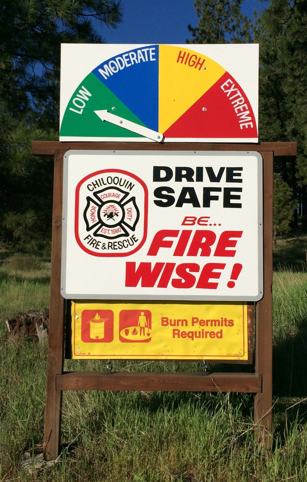
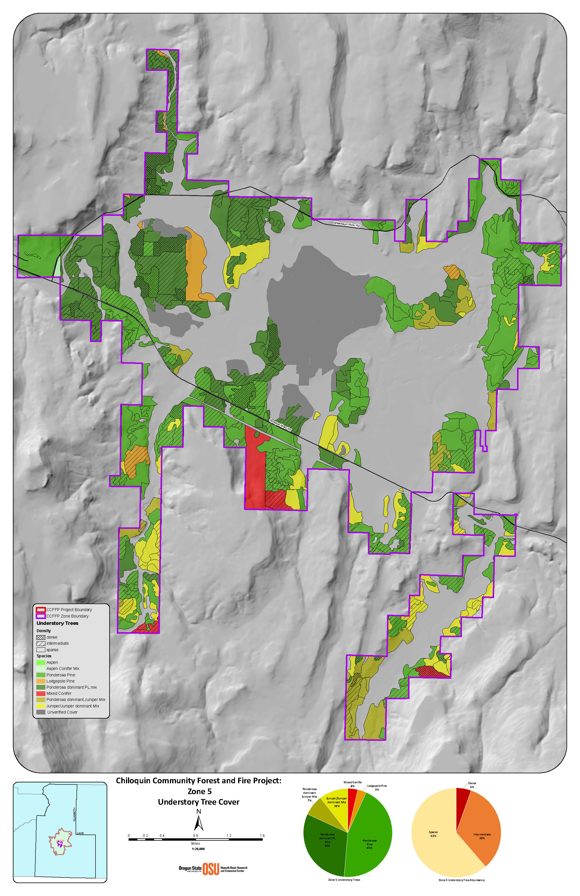
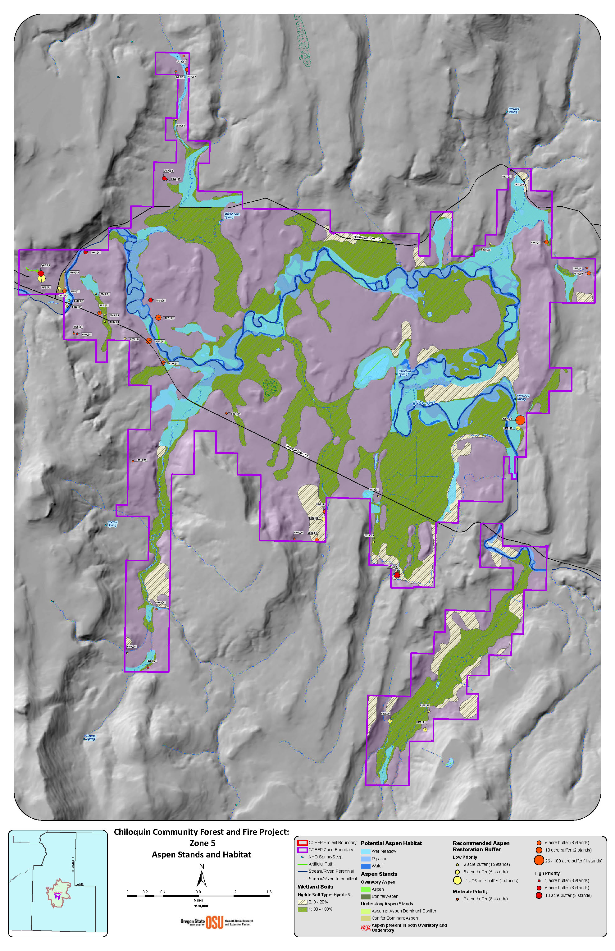
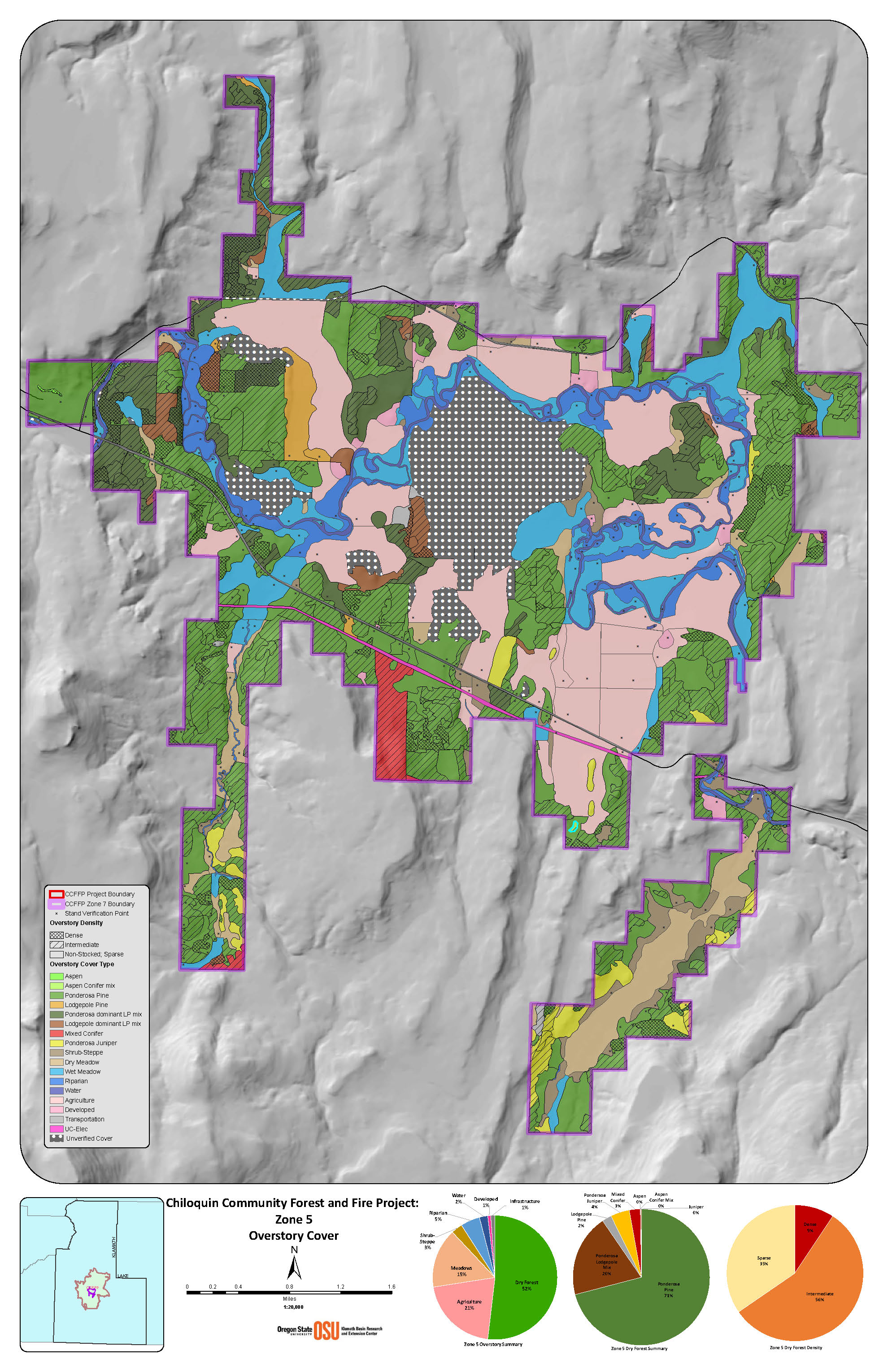
The Chiloquin Community project encompasses approximately 38,800 acres of private land, 60% of which is forested. The entire area is high-risk for wildland fire as identified in the Chiloquin Community and Klamath County Wildfire Protection Plans.
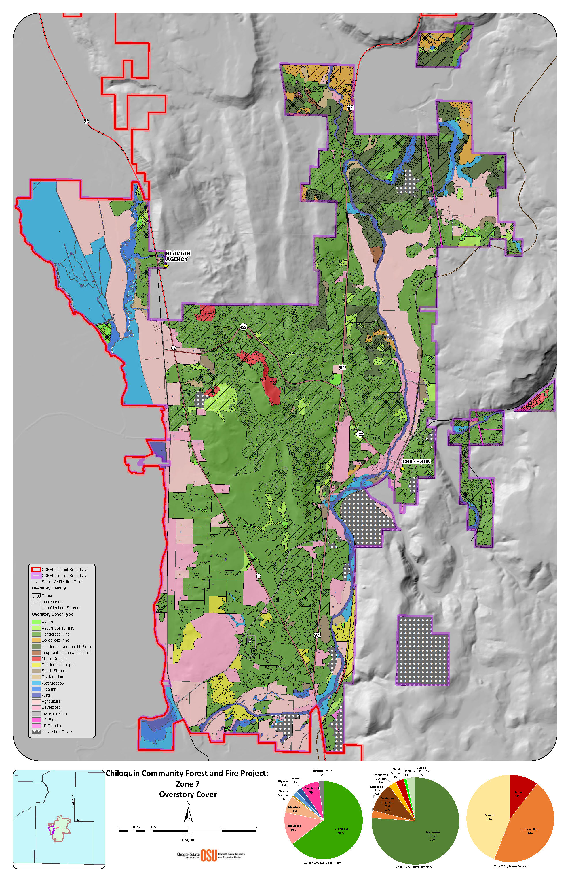
In spring 2017, a preliminary analysis of all private lands in the project area was completed using high resolution aerial imagery. This mapping, done at 1:15,850 scale, delineates stand boundaries and includes an initial classification of overstory cover type, age, and density.
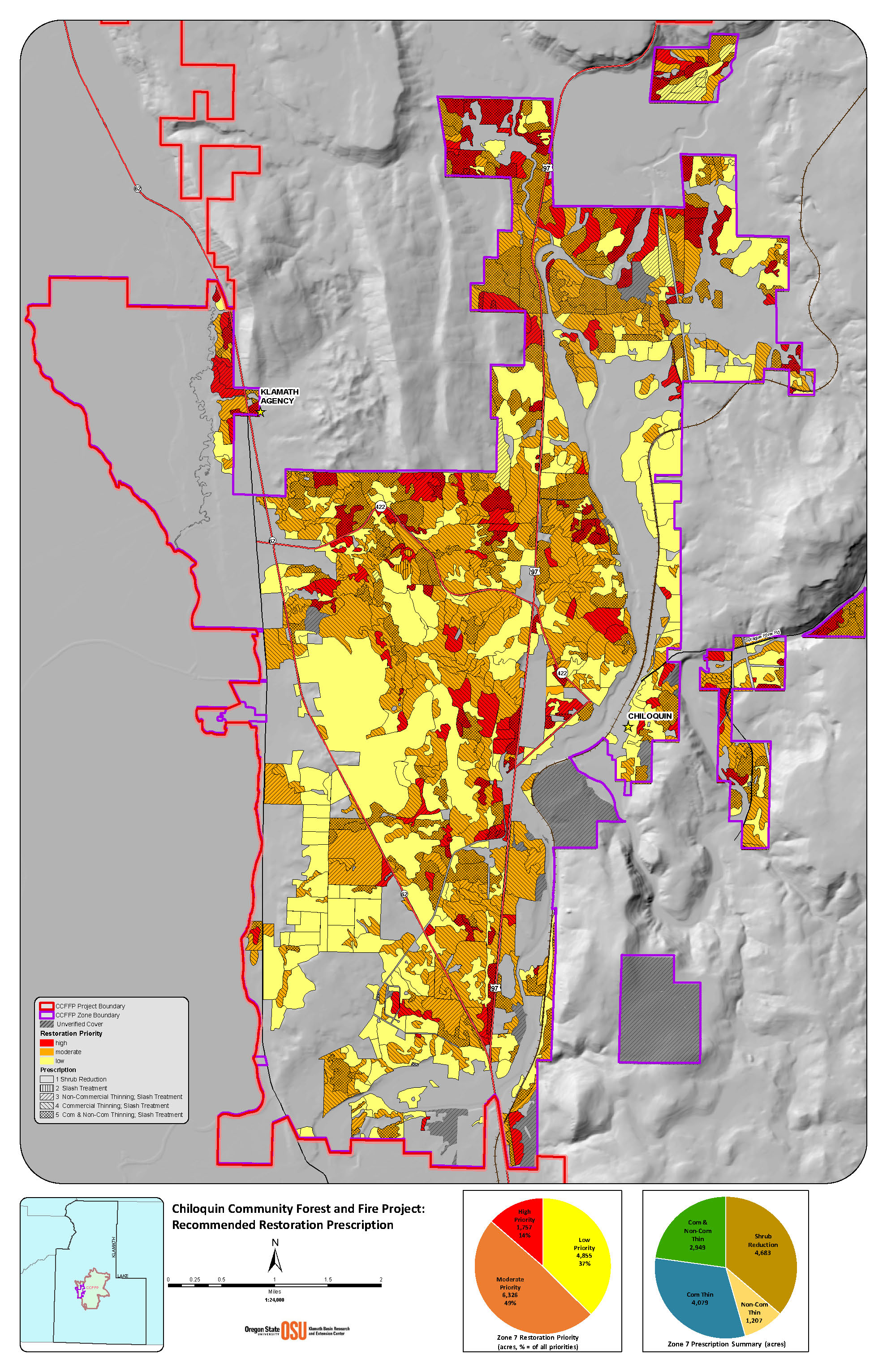
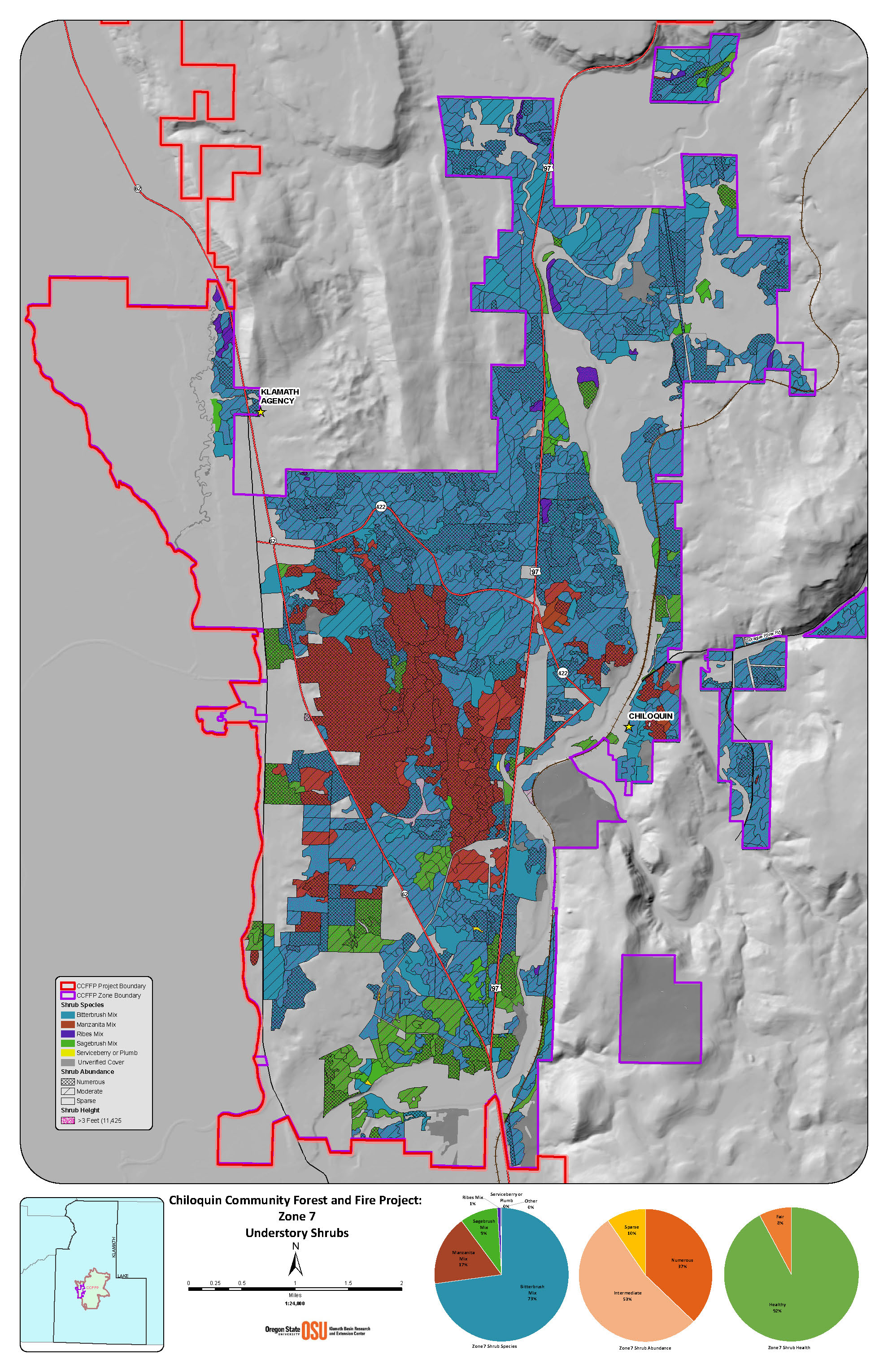
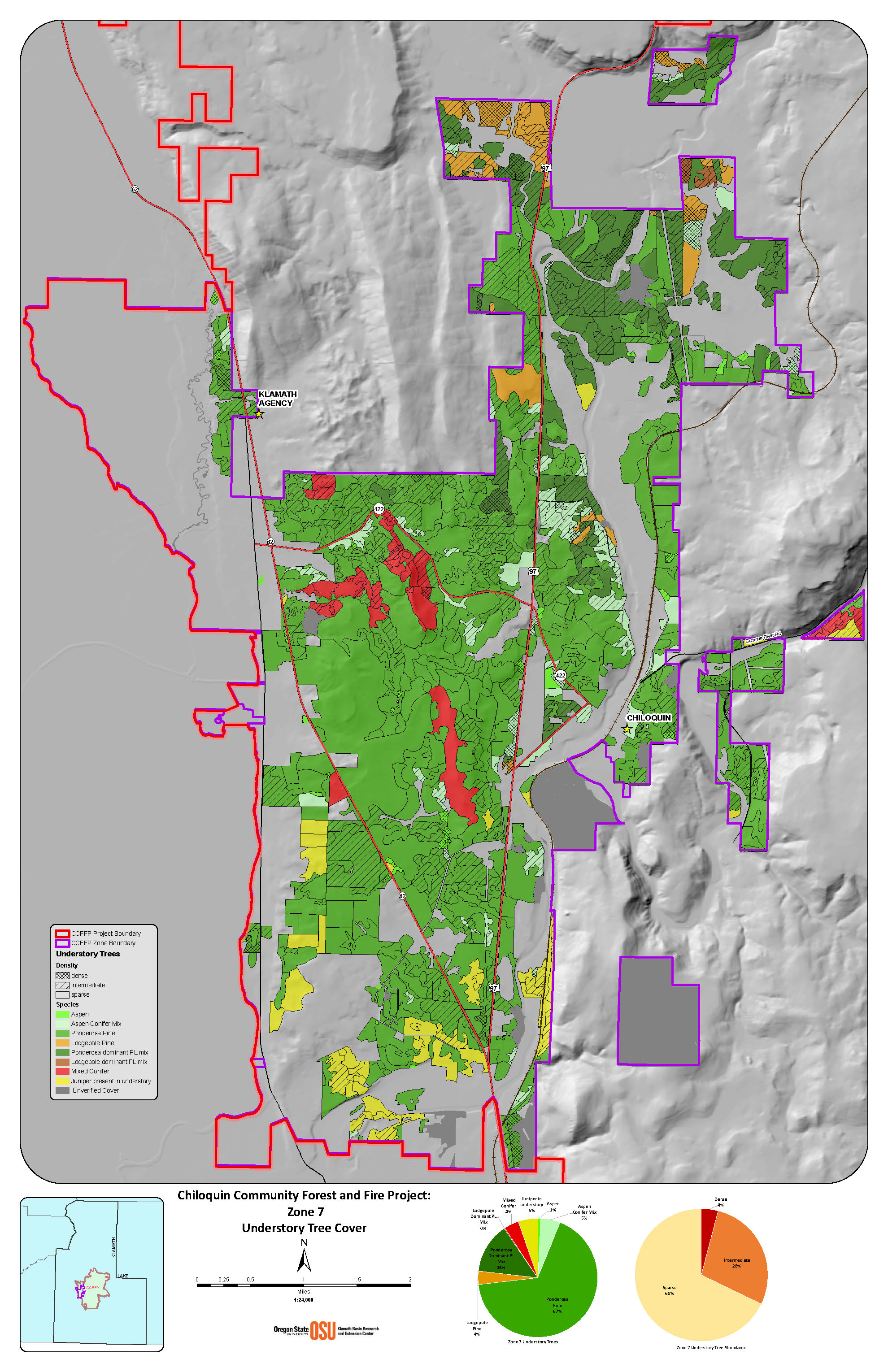
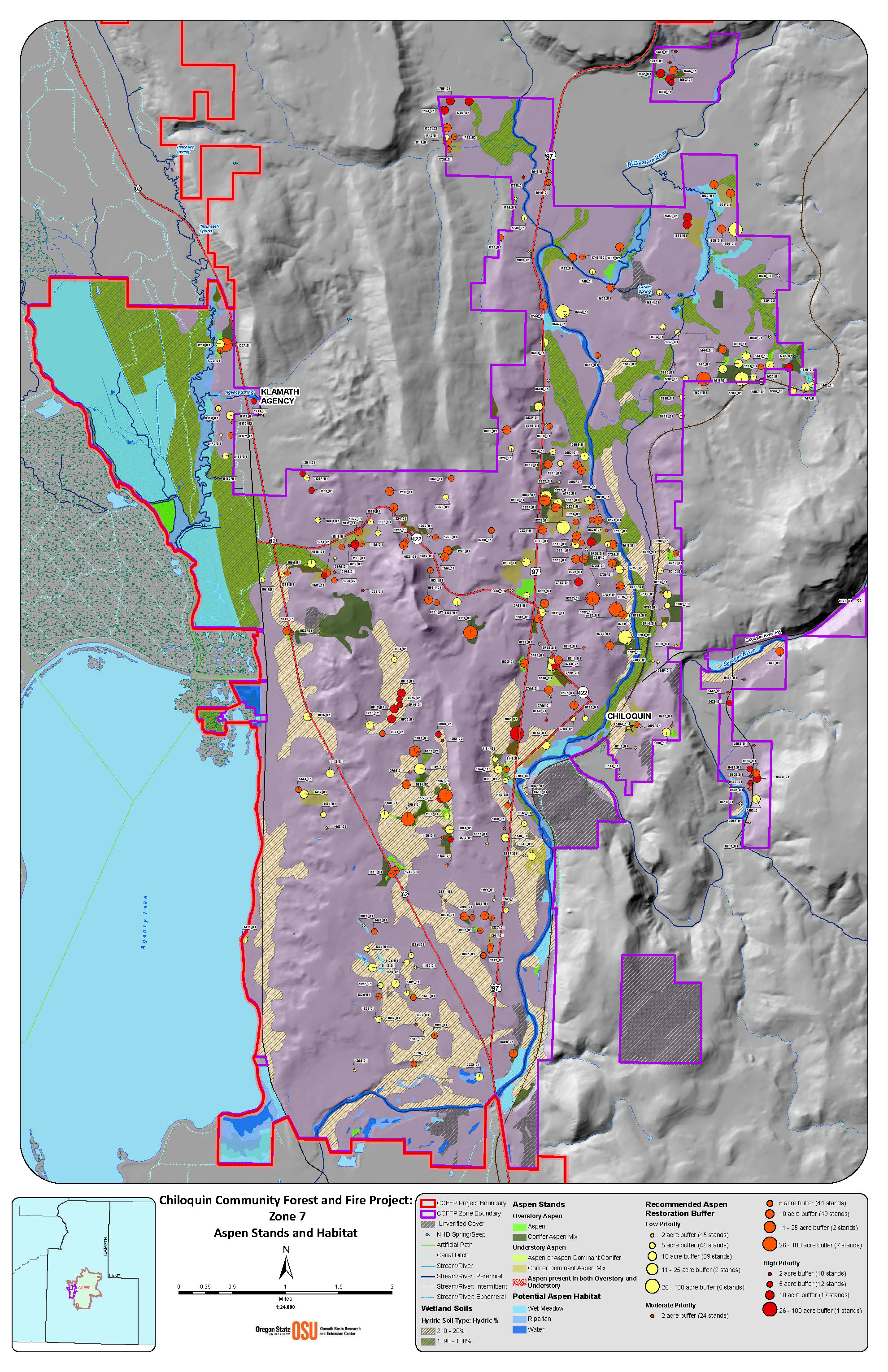
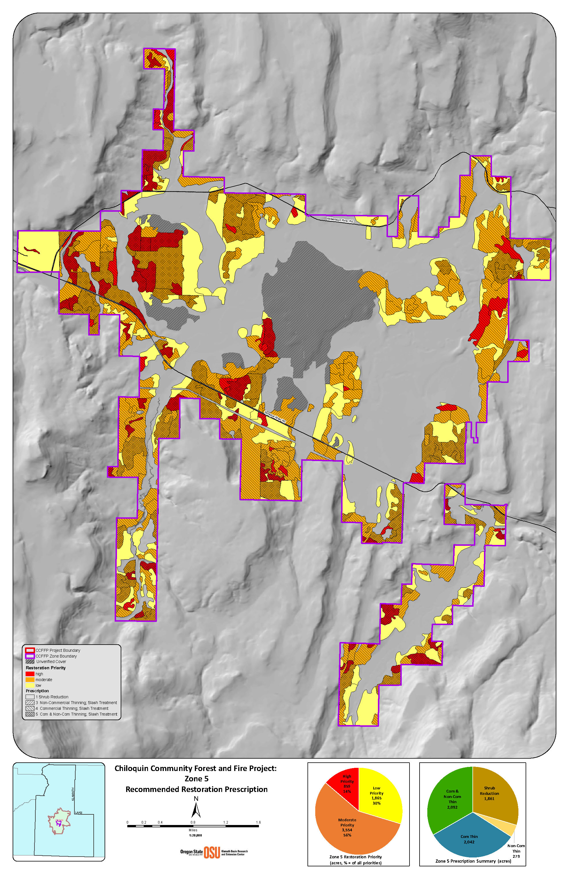
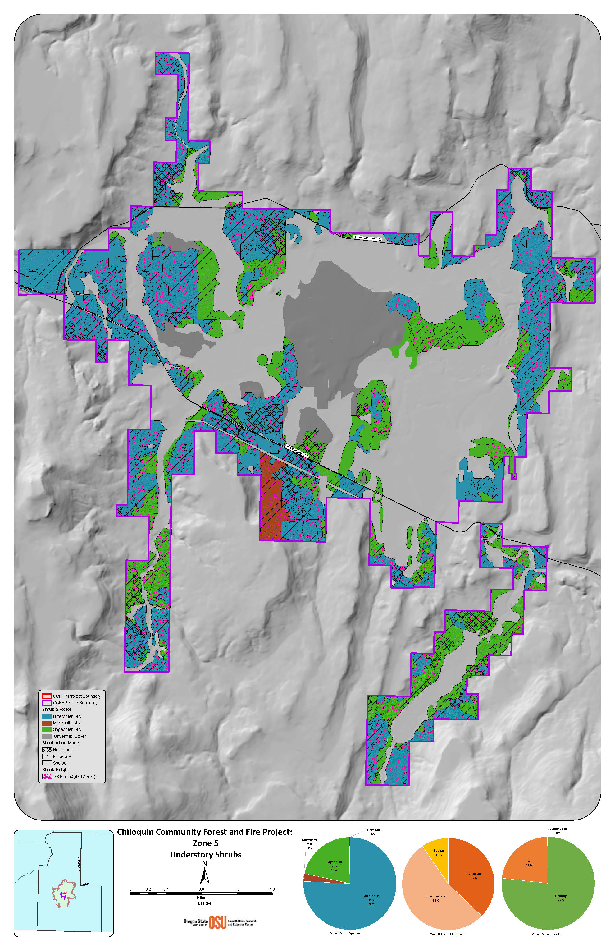
In summer and fall 2017, field validation of forest mapping was conducted by public roads and on properties where landowners were engaged and have granted permission. Maps were completed at the 1:3,600 scale, and stands were classified as high, moderate, and low priority for forest health and fire risk. Scroll through some of the summary maps below.
In partnership with Chiloquin Fire and Rescue, priority maps were expanded to include areas of greatest concern for wildfire risk based on population density, ingress/egress, and other community variables (see map below). In winter and spring 2018, forestry crews conducted wildfire risk assessments in conjunction with door-to-door outreach starting in these high priority areas.
Priority map for forest restoration based on vegetation mapping and wildfire risk to residents and community resources (click to enlarge).
With preliminary mapping complete, for the next few years as landowners, and in some cases subdivisions, became engaged, KLFHP worked with them to identify and implement recommended forest treatments.
Summary map of planned and implemented treatments through 2020
PROJECTS
Partners are now working with landowners to create and implement treatment plans that meet landowner objectives and project goals. Grant funding has been secured through state and federal sources to meet landscape-level implementation objectives over the next few years. Landowners within the project area may contact us to see if any of the current funding is available to be used on their property.
Klamath Watershed Partnership, through a grant from the Oregon Watershed Enhancement Board, began forest health and wildfire resiliency projects across 654 acres of private land (11 landowners) in Fall 2019. Additional benefits of this work include aspen and meadow enhancement and harvest of burned timber.

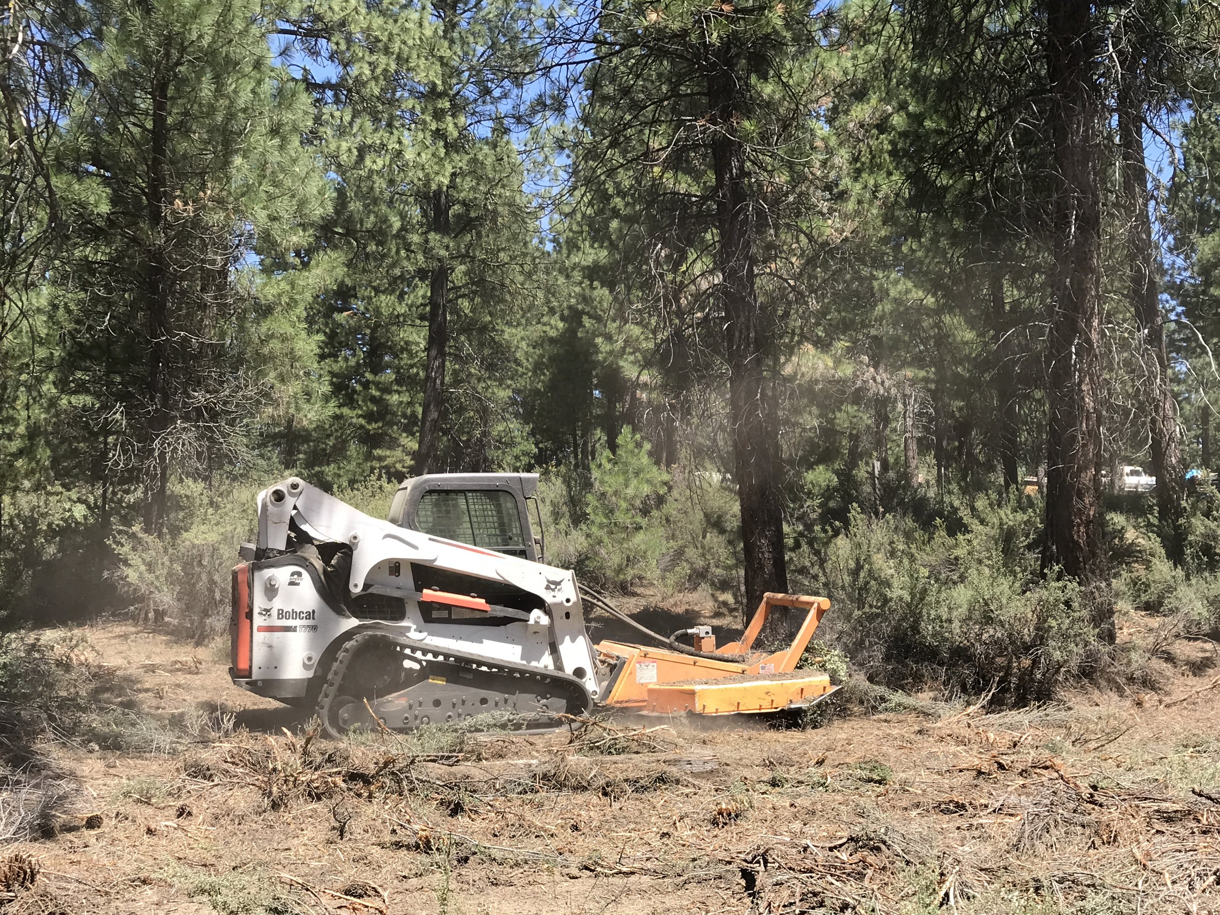
Thinned material was processed and piled for saw log and chip markets.

The contractor cut brush in a thinned area to reinvigorate a healthy and diverse understory and to reduce ladder fuels.
There are currently 32 landowners signed up for forestry treatments funded through the Natural Resources Conservation Service (NRCS). On-the-ground work began in 2020 and will treat more than 3,792 acres . This funding source is providing $3 million for private lands over a 3-year period to landowners with 20 acres or more. Additional funds from NRCS should be available to carry new projects forward for another 3 years.
The Oregon Department of Forestry (ODF) has been working for the last couple of years to treat defensible spaces in the Chiloquin area. This work is conducted by hand crews and small machinery, and is generally focused on smaller acreages with homes. Additionally, through the grant from Coalitions and Collaboratives, the partnership purchased a walk-behind rotary brush cutter to increase efficiencies on these small lots where larger equipment is not practical.

ODF brush work before…

…and after

The walk-behind brush blazer makes quick work of smaller trees and shrubs.
Chiloquin Fire & Rescue conducted on the ground work in the Woodland Park subdivision north of Chiloquin in 2017. With funding from a FEMA grant and field support from the Keno Fire District, workers began thinning dense forested areas, mowing brush, and trimming dead and low-hanging branches on several private lots to reduce fire hazard and fire behavior intensity.
Keno Fire Chief John Ketchum uses their district Bobcat with a mower attachment to remove dense and decadent brush material and smaller diameter trees.

Keno fire crews remove lower branches that may serve as ladder fuels that can take small ground fires and elevate them into the forest canopy.